| AGRICULTURE |
|
||

| |||
We developed an geoportal for agriculture management
using space monitoring. Geoportal is web-based application, allowing you to put
into operation various information rapidly based on services created and
supported by our geoinformation solutions. It is a geo-information complex,
including hardware and software, as well as resupplied databases based on
satellite images and thematic maps.
Agriculture geoportals were introduced for public
authorities in Mykolayiv region and corporate business in Cherkasy and
Vinnytsia regions.
AGRICULTURAL GEOPORTAL OBJECTIVES
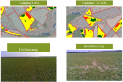
The purpose of the use of space technologies is to provide the most complete agro-objective operational and analytical information for management and technology solutions on plant production, presented in the most user-friendly manner. The geoportal provides:
- integration of all available data in a single information environment;
- visualization of maps and information from databases;
- on-line access in real time;
- management decision-making support for company executives;
- remote access from regional offices and mobile workplaces according to the level of competence of the user.
 |
 |
 |
Basic functions of the
agricultural Geoportal
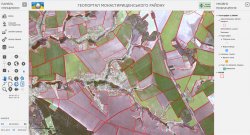
- Interactive navigation on the map; Changes in the list of layers and their visualization sequence;
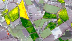
- Displaying images with vector layers;
- Search for objects based on their attributes and location;
- obtaining precise information from the database of the selected objects on the map;
- forming reports and running queries to the database;
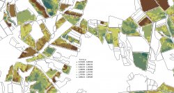
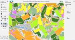
- thematic maps creation;
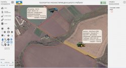
- monitoring the progress of agricultural operations.
 |
 |
 |
Innovative value to users
- Rapid remote assessment of plant agro-production;
- simultaneous line monitoring of the entire territory of crops;
- elimination of the human factor in collecting the operational information;
- obtaining impersonal information in an integrated manner and usable form.
 |
 |
 |
Copyright models were developed as well as mechanisms for processing of remote sensing data, which allow:
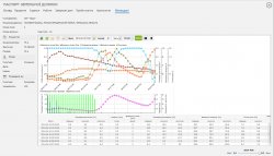
- monitoring the condition of crops in time-mode;
- a qualitative comparison of the fields;
- construction of the substances distribution system in the fields;
- comparison of the fields of "one culture”;
- tracking the fields of agricultural producers;
- construction of distributions of crops in the fields;
- monitoring the machinery operation;
- integration of meteorological data.
 |
 |
 |

